

By Bob Stearns
[dropcap]U[/dropcap]ntil the Internet – and even more recently Sirius Satellite weather imagery – came along, the only available sources of weather information were pretty much limited to NOAA’s continuous VHF weather radio broadcasts, your local TV weatherman, the newspaper, radio DJs, and what you could see in the sky with your own eyes. At the very best none of these provided forecasts that were good for more than 24 hours; as for radio and TV, most were subject to interpretations by those personalities (most DJs were ‘way out in left field, especially when it came to marine weather), and by the time a forecast appeared in the local paper, it was already old news.
And speaking of what you can see, did you know that by using both eyes and ears together you can determine how close a thunderstorm is to your location? Sound travels at one mile per five seconds, and the flash is visible instantly. Twenty seconds between flash and boom is four miles, and so on. By repeating the process every few minutes you can also tell if the boomer is getting closer or moving away. Any thunderstorm within five miles or less creates an increasing and potentially dangerous lightning situation.
Back in the late 1950s when I was in college studying for my degree in meteorology, I also worked on a numerical model a hurricane for one of my professors. This involved hundreds of hours of lengthy mathematical calculations with a cranky mechanical desktop calculator. After months of this, the resulting model was only a very crude approximation of a hurricane and not even remotely close to forecasting any of its future behavior. Today that’s all changed.
Enter the age of computers
Not just because the Internet is such a terrific up-to-the-minute source of information, but equally important because computers provide the necessary horsepower to rapidly crunch the numbers that go with the massive equations used to model the atmosphere and predict its future behavior. This is truly the beginning of a new era in both understanding and forecasting the weather that will only improve with time.
The good news is that today the amount of weather information you can view on your computer is truly vast. You can see weather radar images in motion for your area (or anywhere else in the country, for that matter)that are only minutes old; wind observations, and forecasts that extend many days into the future; sea surface temperatures present and past from a vast reporting network; moon phases – past, present, and future; and tide forecasts for almost any spot on the planet. This is simply a matter of finding the websites suitable for your needs, and that’s what I intend to provide here.
The NOAA Weather Website
This may come as a surprise, considering that Weather Bureau forecasters were often the butt of many jokes in the past because of historically inaccurate predictions, but today the NOAA website is extremely useful and loaded with great information. To get there, go to . . .
This brings you to a colored map of the U.S. Just click on your area of interest, and you get a large scale map of that region, which is further subdivided into smaller areas. Click on the specific area you want to see in more detail, and you get the latest forecast complete with the latest hourly observations (for coastal areas). As a rule, marine forecasts will take you four or five days into the future and are especially helpful in terms of winds.
Keep in mind that while the accuracy of wind forecasting is vastly improved over what was offered only 10 years ago, it still isn’t completely bullet-proof. The longer the forecast period, the greater the chance for error. Usually the first 24 hours is highly accurate, but four or five days down the road it can bust completely if there’s a rapid change in the weather that was not anticipated. Surprisingly, though, it’s often quite good for up to three days.
Each region has its own format for the large scale map you will see on the screen. For example, the Miami region doesn’t look exactly like the Charleston region. But essentially the same basic information appears on both, and the trick is to become acquainted with the various links that can be used to navigate to other information – such as local radar, for instance. Other links listed in the panel along the left-hand side can take you to local marine observations, tropical weather, climate, hazardous conditions, the national weather map, satellite imagery, radars and even unmanned weather buoy observations around the state. Click here to view . . .
This displays a map showing the position of each unmanned weather reporting site. Click on the number of any site, and you see a display of the latest hourly observations from that site. These include wind, air and sea temperature (if measured by that buoy), wave height, and more.
There’s a small graph icon next to each of those observed parameters. Click on it, and you get a graphic display of the history of that parameter that covers the last five or more days. Wind observations from these sites are almost always more useful for us anglers than those from a station miles inland from the coast.
If you’re out on the water and would like to get an update from a particular weather buoy in your area, in many cases you can actually call the buoy on your cellphone. A link posted on the left side of the page that displays the buoy information will tell you how to do this.
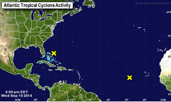
Hurricane season
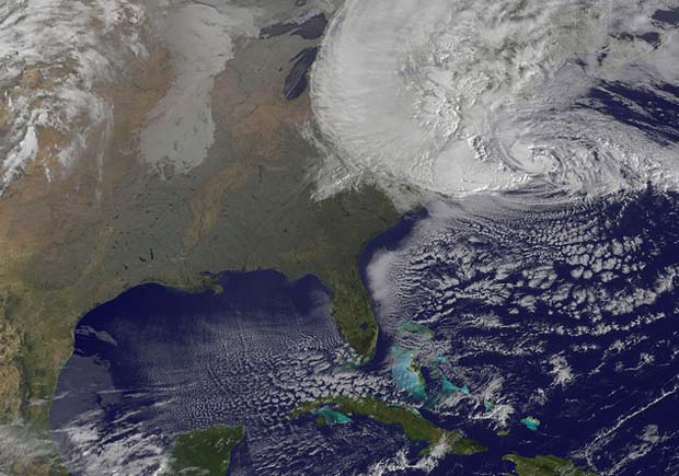
A satellite image showing the enormity of Hurricane Sandy as it makes landfall.
This season of annual anxiety officially begins on June 1 and ends on November 31, but the prime time for the worst of it is August through October. If you’ve lived near the coast for a year or more, you quickly learn that TV and radio are often not the most informed sources of what’s going on when a hurricane looms on the horizon. Especially when it’s way out to sea, which is exactly when you should start thinking about ways to protect your boat and other property. Staying informed is definitely the name of this game.
So here’s a great website that will keep you always up date . . . It contains a huge amount of information that includes the latest warnings, detail discussions, forecast tracks of these storms, satellite images, tropical weather outlooks, reports from reconnaissance aircraft, and much, much more. And if you’re interested in the numerical models that are used in hurricane forecasting, you can even see how their tracks compare with the official forecasts.
Moon Phases
Like most anglers, I pay a lot of attention to moon phases. No only what they will be in the future, but often while looking over my records of trips past and wishing to compare angling results with lunar cycles.
Here’s a great website for all of that information that goes as far into the future (2199 AD) or the past (1800 AD) as you could want. Click here to view . . .
Also available is sunrise/sunset and moonrise and moonset information, and more, all straight from the U.S. Naval Observatory. There’s a link back to the site’s homepage, which yields an abundance of other information that include the latest on GPS, Loran C, and more.
Tidal Information
This website covers both tides and tidal current information for just about any place in the world. You can copy and paste from this website to build your own set of custom tide tables, and like all of the other websites listed above, this information is free. Click here to view . . .
I see all of this as just a beginning; it’s a certainty that more and more will become available with each passing year. It’s there for the asking, and once you find those sites that offer what you want, they’re easily recalled instantly by simply saving them as Favorites or Bookmarks on your Internet browser.
Sponsored