

Fisheries Habitat Mapping
By Tom Karrow
[dropcap]T[/dropcap]he primary objective behind “Ghost Stories,” is the acquisition of environmental knowledge held by elder Bahamian Bonefish Guides, and the generation of fisheries habitat maps. Tom Karrow PhD Candidate, will work with Bahamian elders to effectively generate fisheries habitat maps as a component of his dissertation.
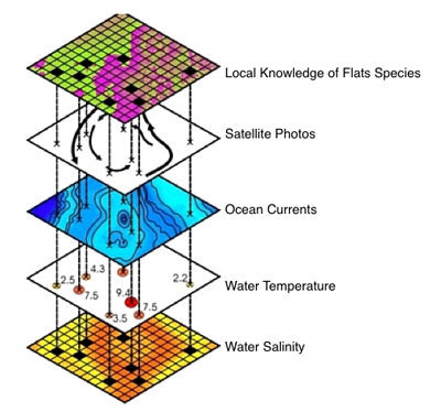
Potential “overlays” using GIS for fisheries Habitat Mapping
Through consulting with locals, a more in depth picture of local resources can be generated, and therefore more comprehensive conservation plans. Further more, in collaboration with elders, local communities gain confidence in interacting with “outsiders,” and greater authority is given to local knowledge.
Bonefish and Tarpon Trust (BTT), leaders in research associated with flats species highlighted the need for fisheries habitat maps in their 2013 Bonefish and Tarpon Trust Journal (pp. 30, 31, 32). The need for these maps, which highlight critical fisheries habitat areas, helps in conservation measures ensuring that established policies are highly effective and ensure greater sustainability of the resource.
“One of the challenges to developing long-term conservation plans for flats fisheries involves no spatial data on the fisheries or habitat critical to the fisheries. Because of this lack of information, it is not possible to create a proactive conservation plan, to address threats to the fisheries and the critical habitats or to address user conflicts . . .
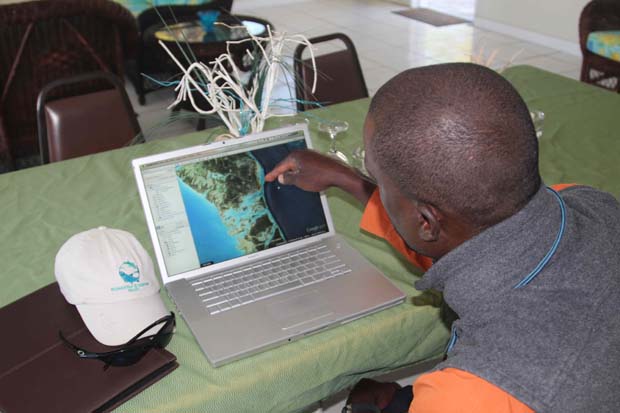
Tom Karrow working with Shawn Leadon at the Andros Island Bonefish Club. Shawn is a son of pioneering Bahamian guide, Rupert Leadon and has a vast knowledge of local ecology and flats species habitat preferences.
The Teddy Roosevelt Conservation Partnership used a mapping strategy to protect important fishing and hunting areas in the American West, an approach that may be applicable in the Bahamas. In this approach, TRCP worked with hunters and anglers to identify areas where they hunted and fished, and also mapped important fish and game habitats. This information was then used to prioritize areas for conservation to ensure that other activities did not infringe upon hunting or fishing or cause damage to habitats. The SAME can be accomplished in the Bahamas to create a (series of) flats fishing habitat conservation map (s). The Map (s) can help to better inform natural resource managers as they design and implement conservation strategies, whether area closures or user-group limitations. Flats fishing areas would be prioritized for conservation, reducing user-group conflicts and lessening the chance that managers will close flats fishing areas.”
Geographic Information Systems (GIS), are computer based mapping systems that allow for layering of various critical features. In the case of fisheries habitat maps, which the research project entitled “Ghost Stories” will generate, the critical layer to acquire is based on knowledge held by elder guides. By locating species specific feeding or spawning habitats, as well as migration patterns, a map layer can be generated and then superimposed over other layers like, coastlines, depth, salinity, currents etc. Computer GIS modeling can then effectively predict changes to fish habitats consistent with changes in currents, coastlines or climate. As such, the generation of fisheries habitat maps for the Bahamas is critical to the long-term conservation of flats species we all love.
If you are interested in learning more about this research endeavor, please contact, Tom Karrow, Lead Bahamas TEK Initiative Researcher and check out his informational website.
Support for this costly endeavor is greatly needed and welcomed. If you are able to, and interested in supporting this venture, please contact Tom Karrow PhD Candidate, tkarrow@uwaterloo.ca or Dr. Aaron Adams, through Bonefish and Tarpon Trust.
A secondary “byproduct” of this research will be the documentation of the history of the Bahamas Flats Fishing Industry. There will inevitably be great stories and tales about the pioneering Bahamian men who established this fishery, so stay tuned for regular updates, and feel free to contribute your own interesting Bahamas based stories from days gone by.
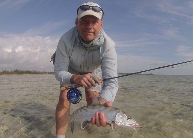
Tom Karrow on Andros, using good local knowledge for success on the flats.
Sponsored

Join the discussion One Comment